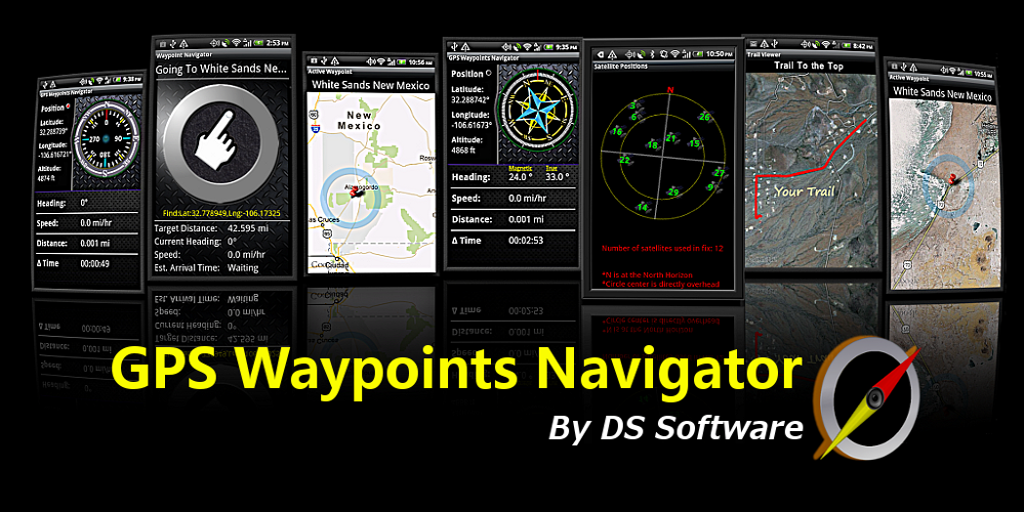
GPS Waypoints Navigator
Convert your phone into the most powerful GPS for Android Powered Devices with GPS Waypoints Navigator, now the worlds most sought-after smart phone navigation aide. With dozens of options for navigating the back-country, waterways and roadways, the tool set found in this software package will quickly become your best friend. Venture beyond network reach using offline maps and tools that only require a good view of the sky. Share important location data with friends who will be able to navigate to your favorite waypoints and find your favorite trails. Get:
- Waypoint and Trail Management Systems.
- Waypoint photography
- Online and offline maps. Cache maps for offline use. Choose maps from multiple sources: Topo Maps, Google Maps, Satellite Maps, OpenStreetMaps- MapNik, Mapquest,Cycling Maps.
- KML file importing and exporting. Export and Email your waypoints and trails. Your exported data will be viewable and navigable on your friends devices and in Google Earth.
- A panel for all your GPS parameters.
- Navigational compasses.
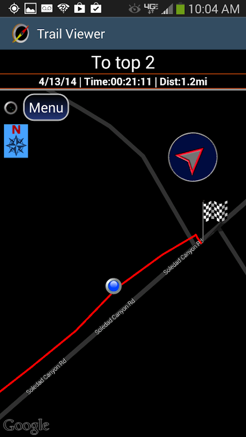
- Trail Recorder.
- Several waypoint creation tools: Enter coordinates, set a waypoint by tapping on a map, save your current position or enter an address (voice entry supported for addresses).
- Two Waypoint Guidance Systems including a dynamic waypoint compass that always points to your target and a new navigation concept- GPS Reflected Pseudo-Radar (available only from DS Software).
- Trail Guidance System.
- Map Search: Supports entry of addresses and coordinates in just about any format including UTM and MGRS.
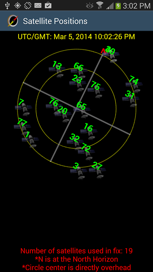
- Satellite reports including satellite signal bar graphs and satellite position mapping.
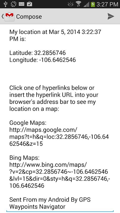
- Email a map of your position. Navigation software not required on recipients device.
- Seamless integration with Google Earth.
- Odometer / Speedometer / Estimated Time of Arrival / Time Remaining.
- Data reporting for marine navigation.
- Supports several coordinate formats: Latitude/Longitude as degrees, deg:min or deg:min:sec, UTM, MGRS.
- Proximity alerts.
- Altitude determined from your position matched to altitude values in land survey databases providing you with values that are more reliable than altitude values returned from your devices GPS chip.
- Map with floating reticule that shows your position with bearing and distance to reticule.
- Sunrise Sunset report- Does not require a network connection. Times are calculated from your position and the date. Useful for planning expedition turn around time or time to make camp.
- Data is backed up allowing battery change without data loss.
- And much more!
- This premium navigation system is ad-free
- Check out our YouTube product demo at: http://www.youtube.com/watch?v=3K9dGhZG73s
- Turn-by-turn driving directions and driving maps.
- You decide how compasses are controlled- By GPS or magnetically. Use magnetic control for indoors, underground or in caves.
- Customized unit reporting: Units reported as either U.S or SI/Metric
- Full control over timer functions and a database recovery/reset option.
- Detailed Help file
- Excellent customer service
- Supports multiple languages: English, Spanish, German, Portuguese, Russian, Chinese (traditional and simplified).
With GPS Waypoints Navigator, every navigation experience will be as easy as a walk in the park!
Whats New
Whats New
- V.8.42 - UPDATE REQUIRED TO GET THE MOST ACCURATE ALTITUDE VALUES COURTESY OF USGS - NATIONAL MAP (USA / AMERICAS ONLY).
Requirements: 2.2+


Download
No comments:
Post a Comment
Note: Only a member of this blog may post a comment.